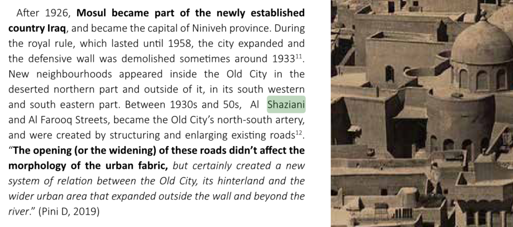
Old Mosul’s most important street is no doubt the Faruq Street, which cuts through the old city from North to South.
It was built in two phases: the first started in the 1930s and runs from Bab Jadid to the Saa’a Church. This is sometimes refered to as the Old Faruq Street شارع الفاروق القديم
The second phase continues northwards from the Church through what was then called the Khatuniyya district. This was often referred to as the New Faruq Street, although this distinction seems mostly forgotten by locals today.
Of course building the road meant destroying many houses and mosques to clear the path. I always say that there are two things that destroyed old Mosul: Da’esh and al-Faruq Street.
In any case, I am writing this post to discuss another name for the road that appears on Google Maps specifically, and nowhere else as far as I can see.
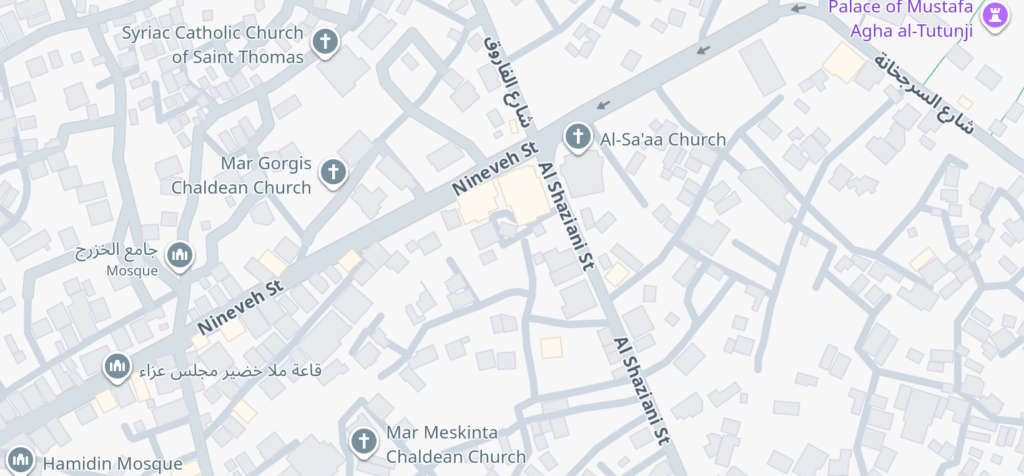
Al Shaziani Street – this is the name of the street from the Saa’a Church southwards, but where does this name come from? And who is Al Shaziani?
From all of my reading and researching about Mosul, I have never come across this name in Arabic. Is it الشذياني ? or الشازياني ? Or some other spelling?
No classical Arabic sources mention this name. I have seen it in some modern sources, e.g. this article about the Saa’a Church mentions it here. I have also seen it in some UNESCO documentation about the city, but these sources almost certainly got this from Google Maps.
So how did this name end up on Google Maps? My guess is that it was used as a placeholder when entering the data for Mosul’s street names and was simply never corrected.
Other online maps such as Bing Maps or Apple Maps do not have this mistake and simply name it شارع الفاروق
I recently sent a feedback report to Google Maps notifiying them of this mistake – it would be nice to see it get fixed.